Arkansas's 303(d) List, 305(b) Report, and Assessment Methodology by Year
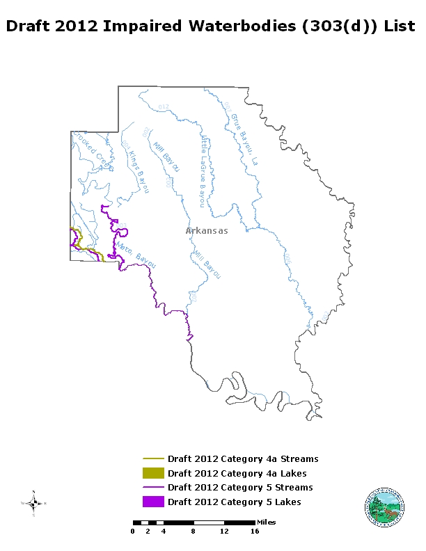
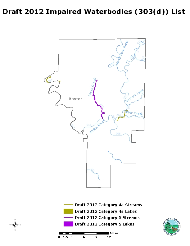
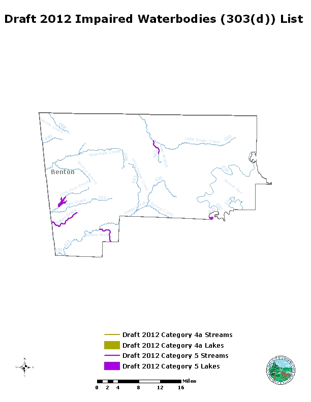
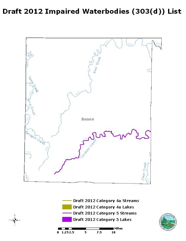
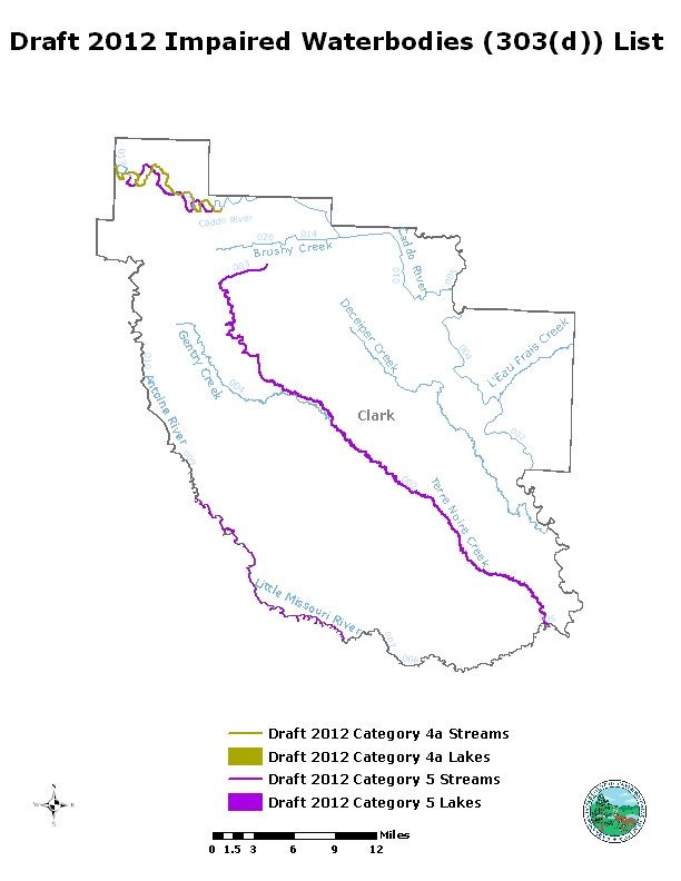
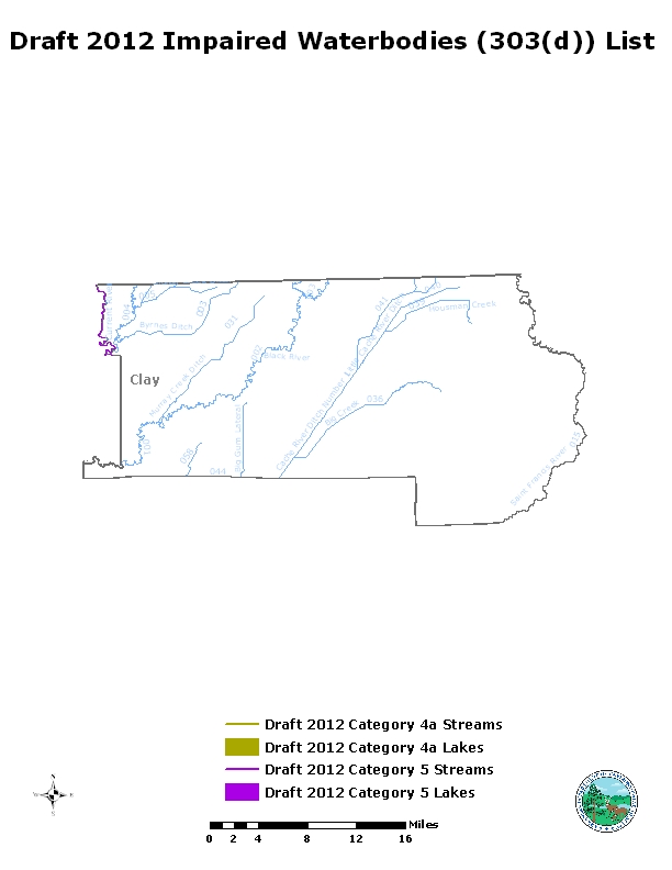
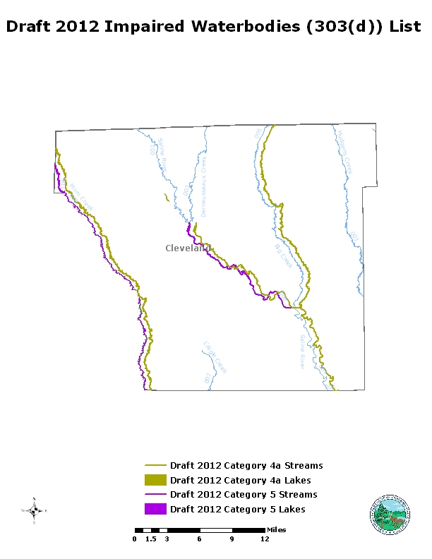
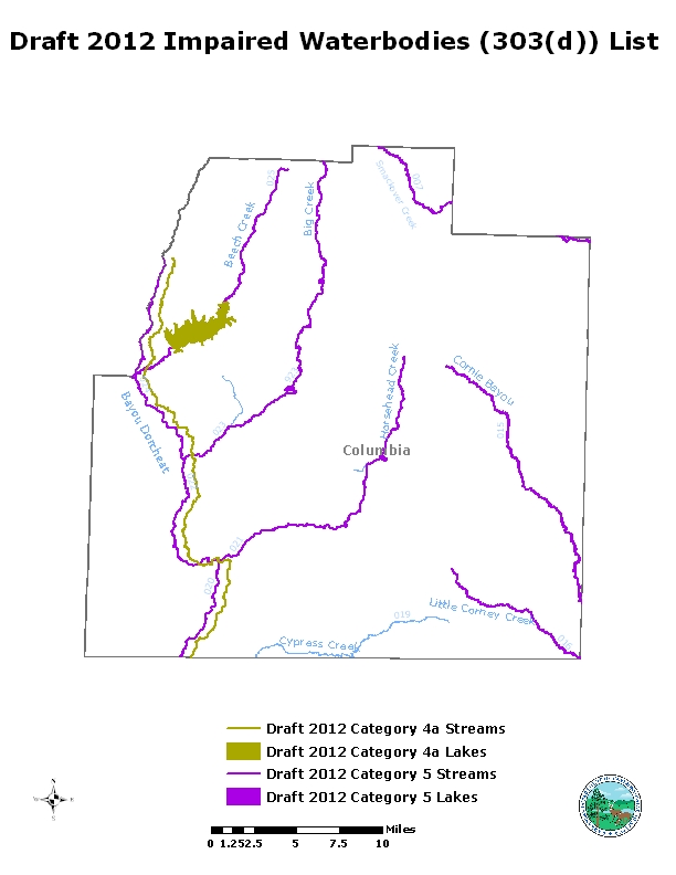
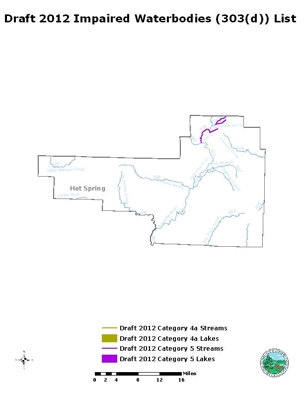
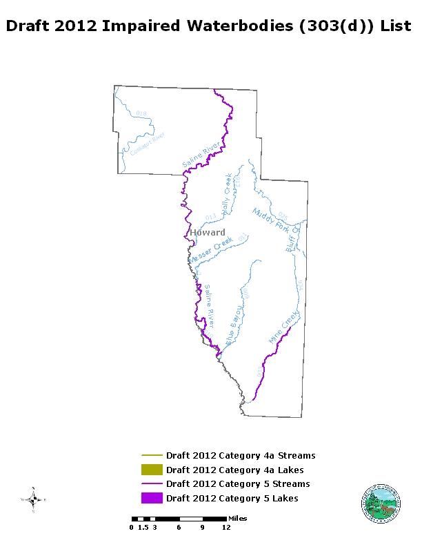
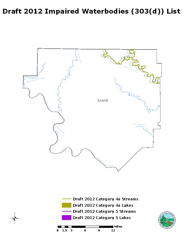
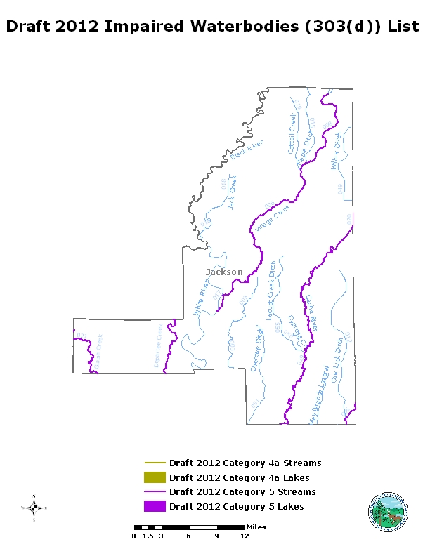
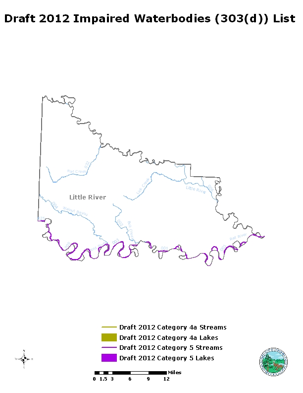
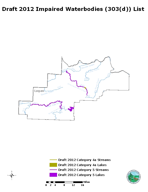
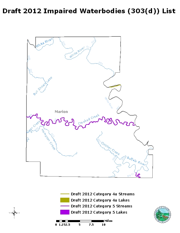
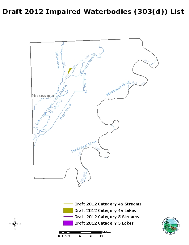
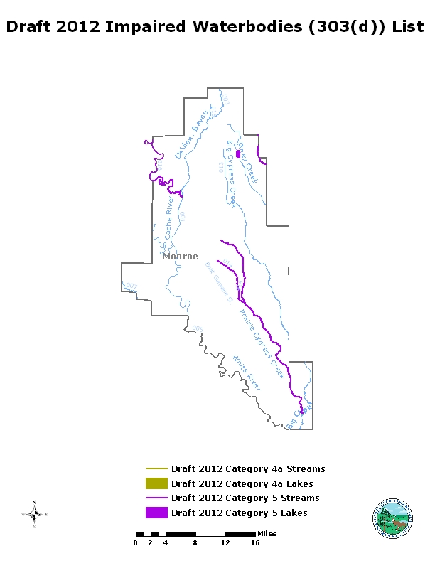
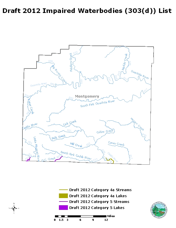
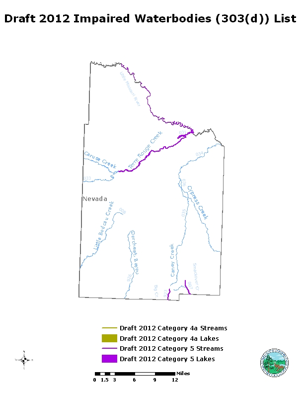
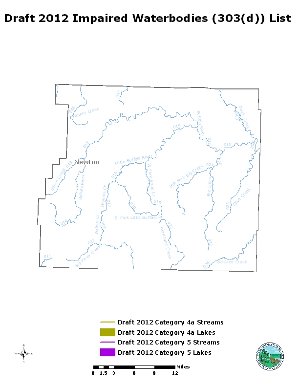
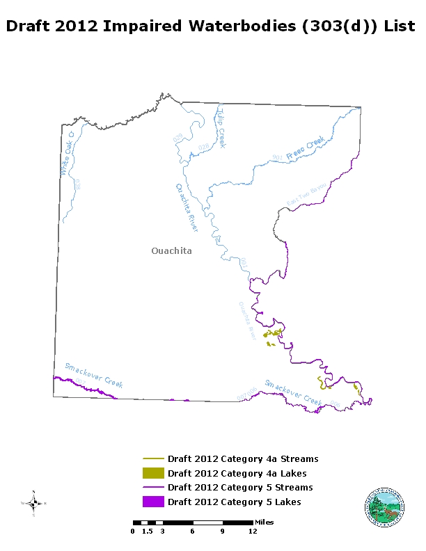
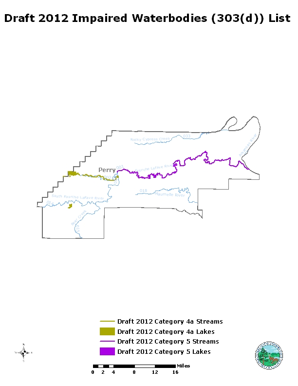
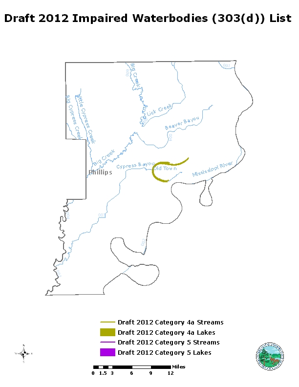
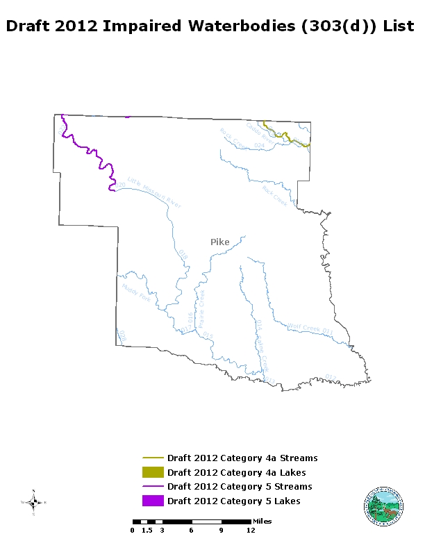
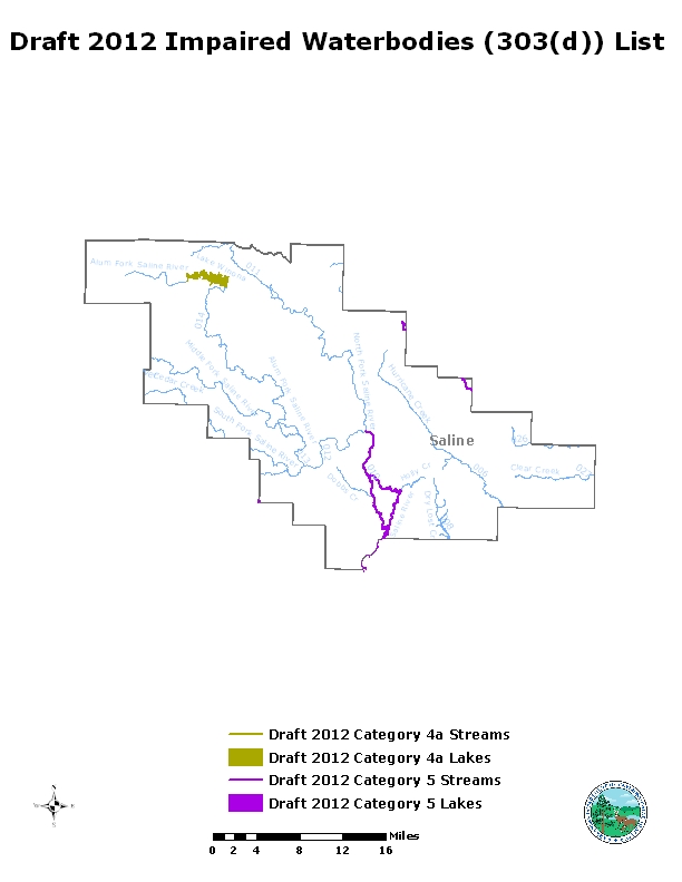
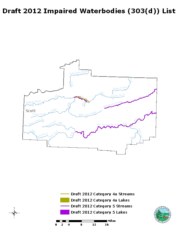
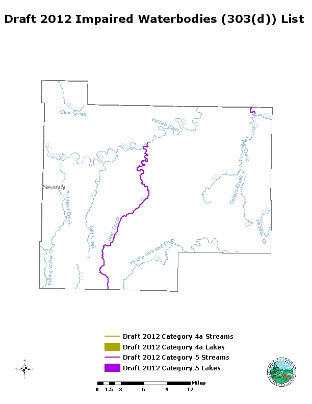
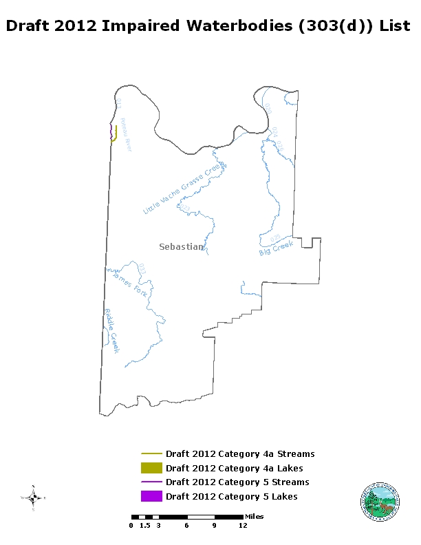
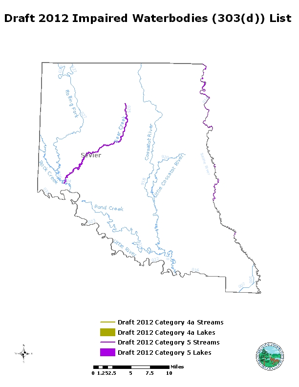
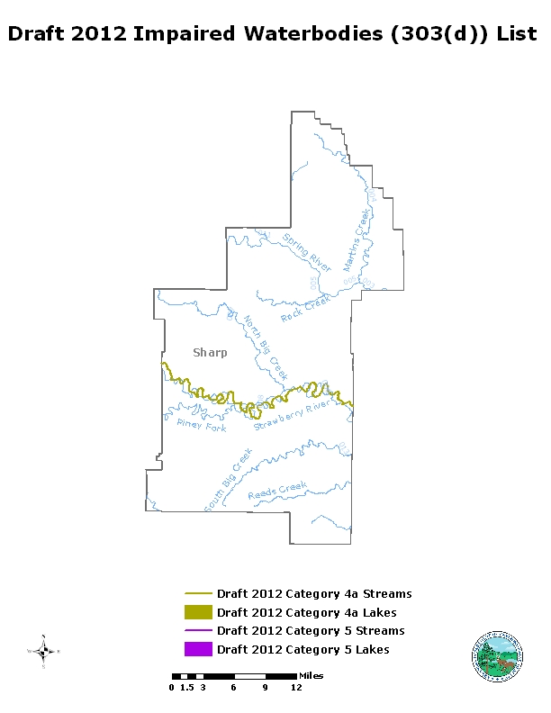
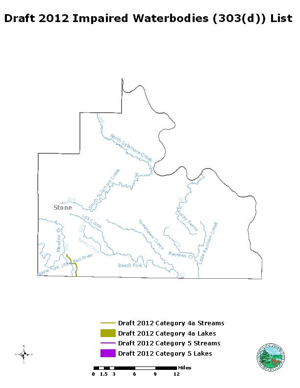
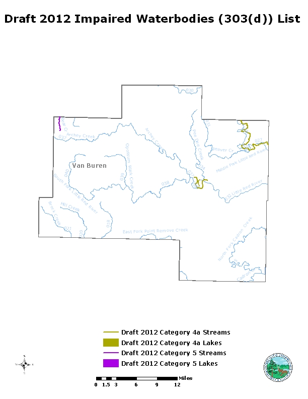
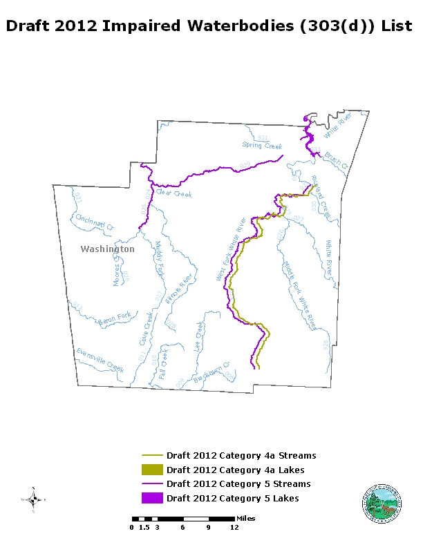
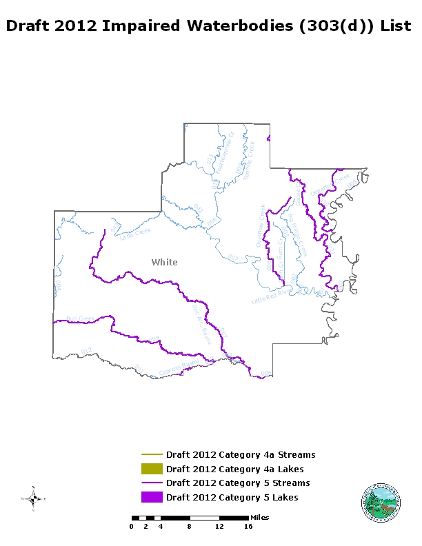
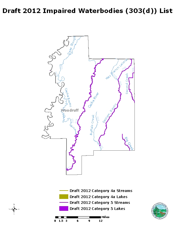
The 303(d) list is developed by DEQ every two years under provisions of Section 303(d) of the Federal Clean Water Act. DEQ assesses water quality monitoring data from numerous locations around the state and utilizes a comprehensive assessment methodology to determine which waters are not meeting their designated uses or water quality standards as listed in the Arkansas Water Quality Standards, 8 CAR Part 21 (Rule 2).
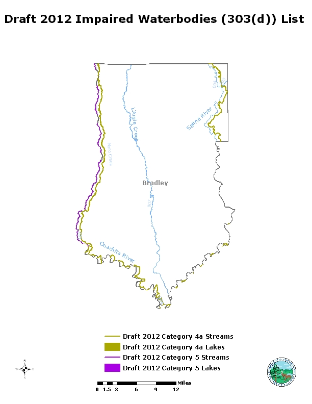
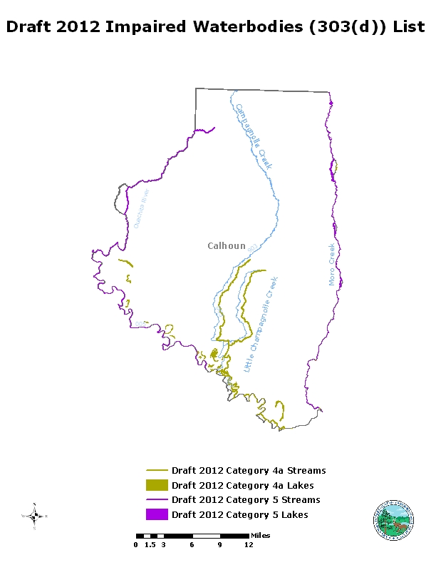
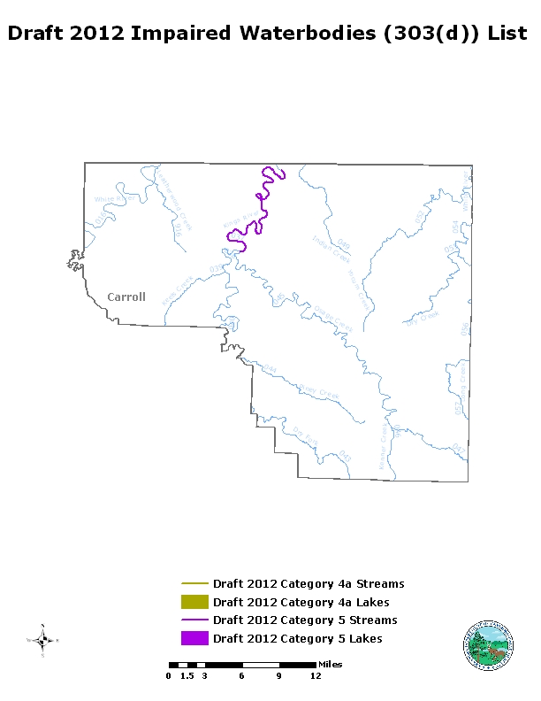
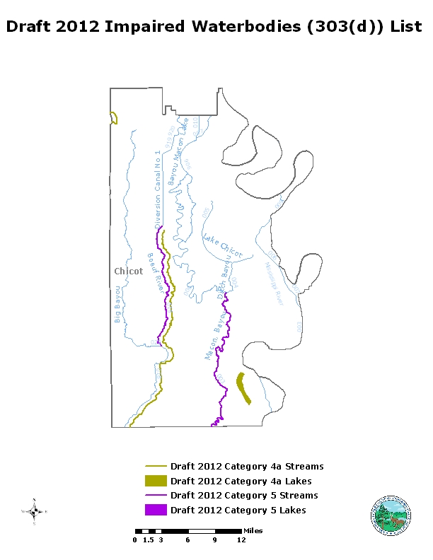
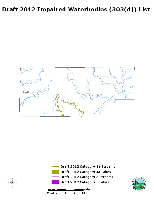
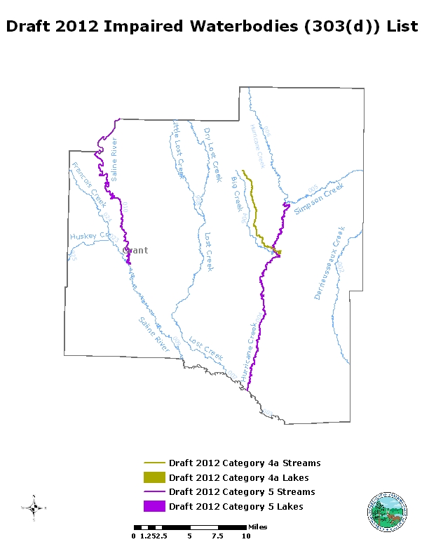
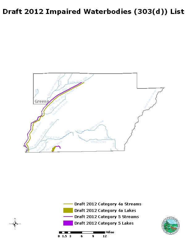
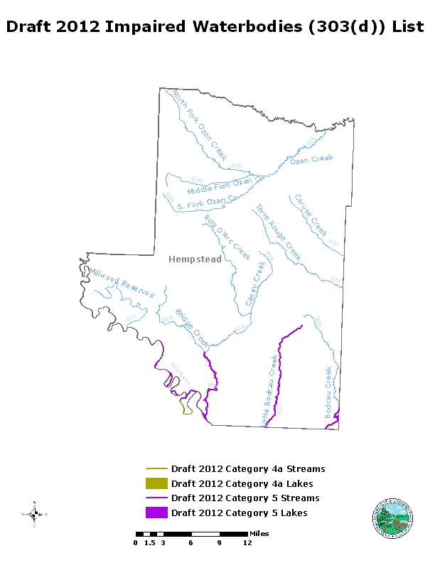
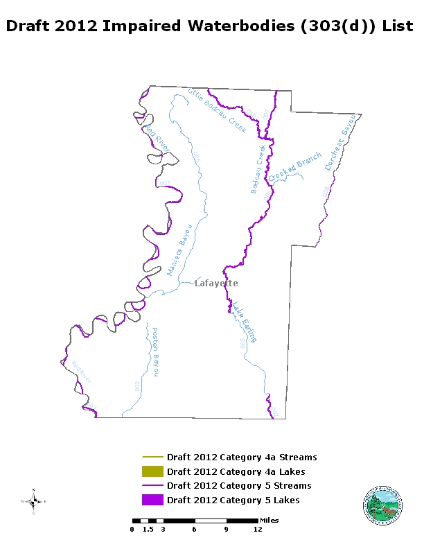
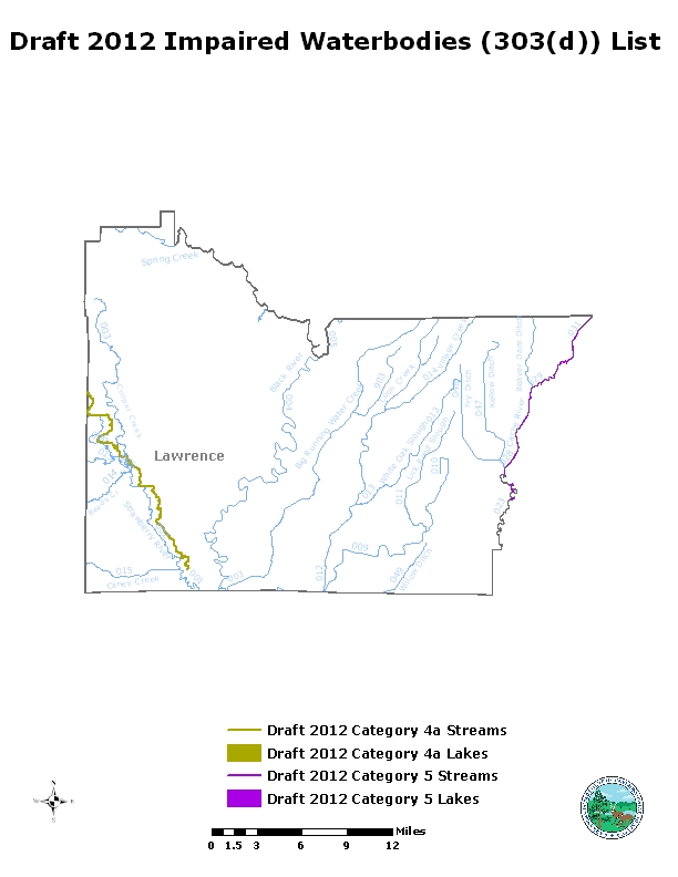
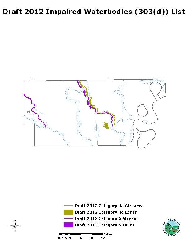
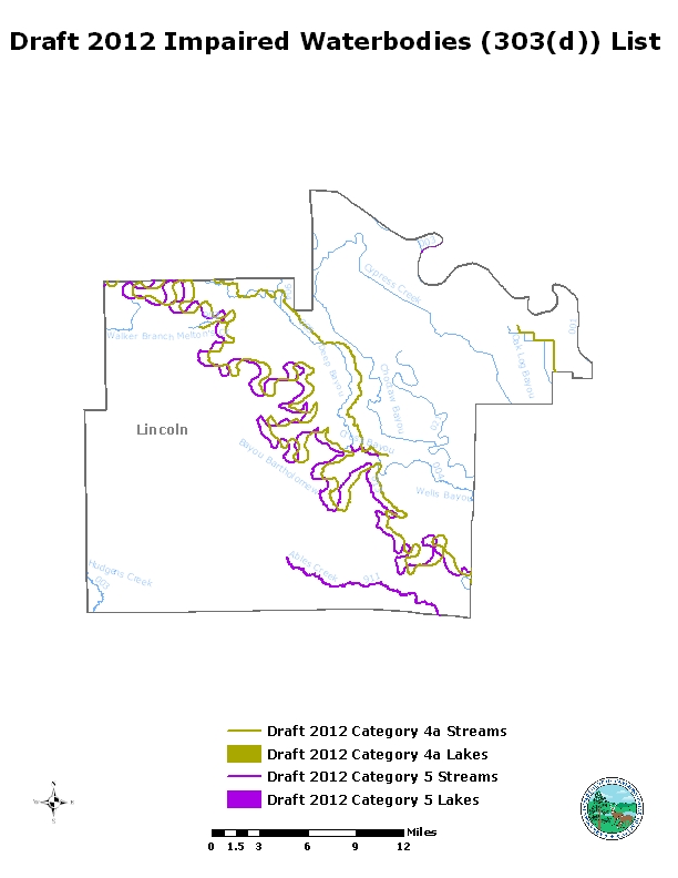
2020 Impaired Waterbodies – 303(d) List
Letter RE DEQ comment on 303(d)
Exhibit A - Osage and Spring Creek Water Quality and Ecological Assessme
Exhibit B - King - Joint Study Committee Final Report
Exhibit C - Fish - low level nutrients in ozark streams 2010 May
Exhibit D - Email to EPA 2024-02-21 RE DEQ assessemnt of Spring Creek
Exhibit D attachment - Spring Creek Fish Data
Exhibit D attachment - Spring Creek short term continuous assessment
2020 Impaired Waterbodies List
Arkansas 303(d) Record of Decision
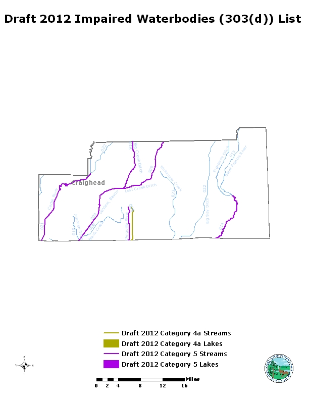
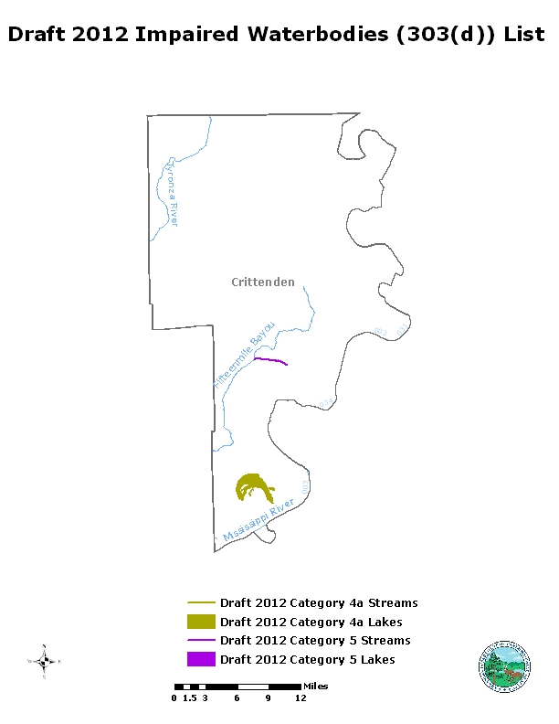
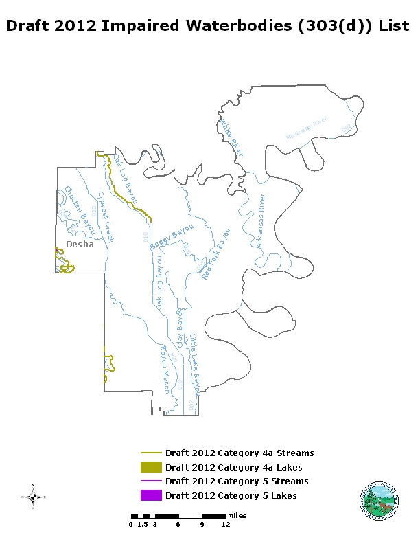
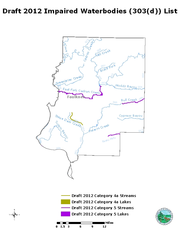
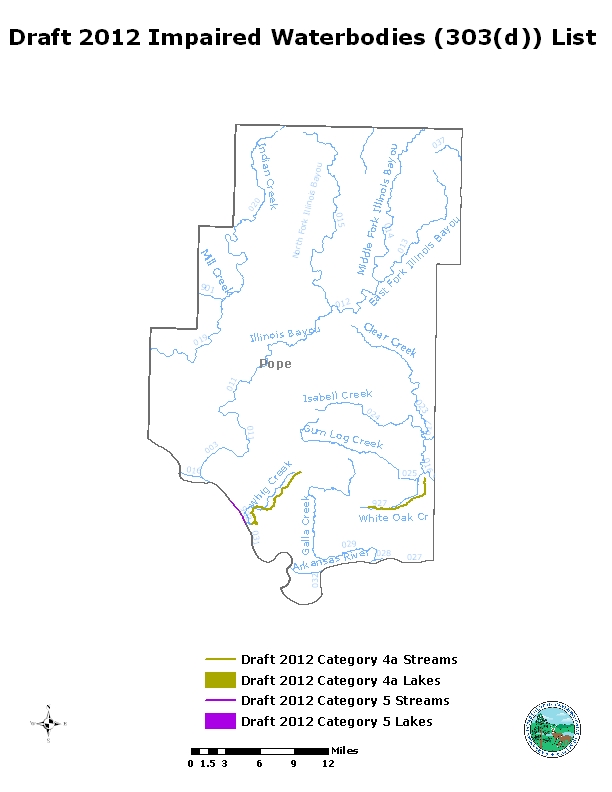
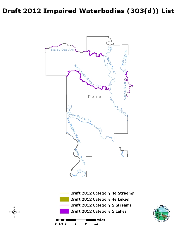
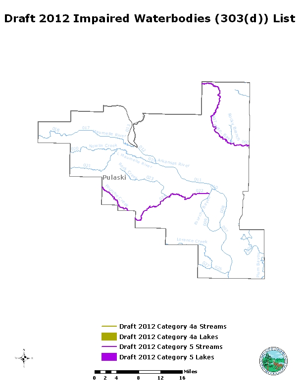
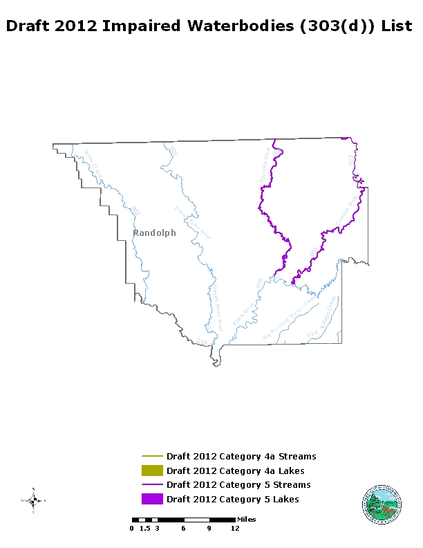
Draft 2020 Impaired waterbodies List
2018 Impaired Waterbodies – 303(d) List
- Public Notice
- Executive Summary
- Draft 2018 303(d) list
- 2018 303(d) list StoryMap
- Draft 2018 Waters with TMDLs or Other Alternative Pollution Controls in Place
- Assessment Categories
- Response to Comments
- 2018 303(d) List
- Final-2018 305(b) Report
- EPA Action Letter
- Oral Public Comments
- Adam Schaffer
- Aletha Tetterton 2
- Aletha Tetterton
- Alex Kent
- Alice Andrews
- Alice Doyne
- Alice Shands
- Alison Hester
- Allison Hubbard
- Amanda Harris
- Amy Hudson
- Andrea Moerman-Herzog
- Andrea Morrow
- Andrew Lee
- Andy McCutcheon
- Angela Brown
- Angela Cope
- Ann Owen
- Anna H
- Anna Weeks - Ar Public Policy Panel
- Anne Holcomb
- Annee Littell
- Annette Pettit
- Austin Lee
- Bailey Stinnett
- Barbara Hinton
- Barbara Reding
- Barry L Martindale
- Becca Davis
- Belinda Jonak
- Beth Ardapple
- Beth Forbes
- Beth Seward
- Bianca Armstrong
- Bill Pettit
- Billy Shatwell
- Bo Verser
- Bob & Kathleen Sinclair
- Bob Allen - AR chapter Serria Club
- Bob Allen - Arkansas Canoe Club
- Bob Carlson
- Bonnie Laycock
- Brad Chilcote
- Brad Taylor
- Brandon ONeal
- Brandy Whaler
- Brenda Tirey
- Brian Pruitt 2
- Brian Pruitt
- Brian Thompson
- Bryan Rupar
- Byron Eubanks
- C. Nagel
- Cameron Mullins
- Carol Bitting
- Carole Lane
- Carolyn Hendricks
- Cece Hillard
- Chally Sims
- Charles Allen Carney
- Charles Finch
- Charles Transue
- Charlie McGrew
- Cheryl Clayborn 2
- Cheryl Clayborn
- Cheryl Johnson
- Chris DeClerk
- Chris Handley
- Christian De Vries
- Christopehr Fischer
- Chuck Bitting
- Ciarra Murphy
- Cindy Jetton
- Clifford Brown
- Cody Lorge
- Colene Gaston - BWD
- Corbin Stinnett
- Craig Gann
- Cristine Slikker
- Dan Cohee
- Dan Henry
- Dan Scheiman - Audubon Arkansas
- Dana Murdock Banks
- Dane Schumacher
- Danielle Nielson
- Darcia Routh - Arkansas Department of Health
- Dave Mcphail - Friends of the North Fork and White Rivers
- David Adams
- David Byrd
- David Dougan
- David Finch 2
- David Finch
- David Kuhne
- David Martinson
- David MuCullough
- David Parker
- David Peterson - Ozark Society
- David Sloan
- David Smith
- David Wright
- Dawn Cain
- Dean Castle
- Debbie Alexy
- Debbie Doss - Arkansas Watertrails Partnership
- Delwin Slater
- Demaris Elkins 2
- Demaris Elkins
- Denise Barton
- Devan Wright
- Don Davis
- Don Hamilton
- Donna Combs
- Donna Haynes
- Donna Peterson
- Donnal Walter
- Doug Johnson
- E. J. Buchanan
- Ed Brocksmith - Save the Illinois River
- Ed Brocksmith 2
- Ed Brocksmith
- Edie Stahl
- Eilish Palmer
- Elaine Adams
- Elene Murray
- Elizabeth Cantwell
- Ellanorah Wilson
- Ellen Corley
- Ellen Fennell
- Ellen Hughes
- Ellen Mitchell
- Emily Kearns
- Evelyn Sammons
- Faith McLaughlin
- Faith Mullins
- Faron Davidson
- Fay Knox
- Forrest Payne - Friends of Fourche Creek
- Frances Buchanan
- Frank Barton
- Frank Wright
- Frieda Schroder
- Frita Ohlson
- Gary Moody
- George Wise
- Gina Booth
- Ginger Milan
- Glenda Allison
- Gordon Watkins - Buffalo River Watershed Alliance
- Grant Scarsdale 2
- Grant Scarsdale
- Greg Grant & Paula Haynes
- Gregory O'Neal
- Gundel Martin
- Hal Holliday
- Hank van Rossum 2
- Hank van Rossum
- Harmon Chadbourn
- Harrison Hamer
- Heather Huckeba
- Heather Smith
- Helan Kling
- Helen Pounds
- Holly Adams
- Holly Pilgrim 2
- Holly Pilgrim
- J Keith Grimwood
- J Murdoch
- James Brandenburg
- James Krieger
- James Mcginty - Haliburton
- James Morrow 2
- James Morrow
- Jana Browning
- Janet Larger - Newton County Assessor
- Janice West
- Janine Perlman
- Jann Bell
- Jean Pritchard
- Jeff Hood
- Jeff Ingram
- Jeffery Hood
- Jeffrey Ingram
- Jerell Mullens
- Jerry Hillard
- Jerry Vaughn
- Jessica Luraas
- Jessica Wall
- Jessie Green - WRW
- Jim Hampton
- Jim Kuzilik
- Jim Westbrook
- JM Lanaford
- Jody Zimmermann
- Joe Golden
- Joe Smith
- John Bailey - Arkansas Farm Bureau
- John Barton
- John Chamberlin
- John Creagar
- John Czarnecki
- John Earney
- John Taylor 2
- John Taylor 3
- John Taylor
- John Van Brahana
- John Watkins
- Jonna Hussey
- Joseph Beil
- Joseph Hutchison
- Joseph Nelson
- Joy Harwood
- Judi Nail
- Judi Richardson (2)
- Judi Richardson
- Judith Faust
- Judith Stewart-Abernathy
- Judy Maruer
- Judy McCutcheon
- Judy Quattlebaum
- Judy Singleton
- Julie Campbell
- Justin Cloar
- Justin Stroman - AGFC
- Karen Anderson
- Karen Geiger
- Karla Walden Caraway
- Katherine Goodwin
- Katherine Koch
- Kathryn Hill
- Kathy Downs
- Kathy Roberts
- Katy Starnes 2
- Katy Starnes
- Kay Fulton
- Keep Little Rock Beautiful
- Keith Runion
- Kelley Stinnett
- Kelly Mulhollan
- Ken Duncan
- Kenneth & Tracie Pape
- Kenneth Carle
- Kent Landrum
- Kevin Carey
- Kris Smith - National Park Service
- Kristin Albrecht
- Kurt Wekborn
- L Barham
- Lacey Horn
- Larry Keith Harvey
- Larry
- Laura Ruhl
- Lauren Chensey
- LeAnn Evans Holmes
- Leezh Hayes
- Lin Wellford
- Linda Haycook 2
- Linda Haycook
- Linda Payne
- Linda Simmerman
- Linda Sue Goosen
- Lisa West
- Liz & Juergen Lottman
- Liz Ruby
- Lloyd & Linda Stith
- Lora Smith
- Loretta Crow
- Louetta Ricketts
- Lowell Dillard
- LuAnn Baker
- Luanne Blaylock
- Lucinda Summerlin
- Lucy Sauer
- Lydia Jane Michaels
- Lynn Parker
- Lynn Risser
- Madison Fleeman
- Mara Leveritt
- Marcy Benham
- Margaret Chaisson
- Margaret Cheek
- Margaret Morrell
- Margaret Smith
- Maria Morules
- Marian Johnson 2
- Marian Johnson
- Marianna O'Dea
- Marie Langer
- Marilyn Fouts
- Marilyn Sutton
- Marissa Davis
- Marita Nazariau
- Marjorie Lacy
- Mark & Colleen Hajek
- Mark & Elizabeth Meier
- Mark Davis
- Mark Richards 2
- Mark Richards
- Marquita Den Herder
- Marti Olesen
- Mary Anita Zisner
- Mary Ellen Watson
- Mary Imelda McClinton
- Mary Jane Hickey
- Mary Miller
- Mary Schlatterer
- Mary Simonson
- Matt Cleveland
- Matt Pekar
- Melanie Honeycutt
- Melanie Norris
- Melissa Jane Murphy
- Melissa McCall
- Melissa Tripplett
- Michael de Bays
- Michael Haddigan
- Michael Haley
- Michael Luther 2
- Michael Luther
- Michael McLellan
- Michael Warren Kilpatrick
- Michael
- Michele Langston
- Mike Finley
- Mike Kish Jr.
- Mike Quearry
- Mike Steelman
- Miranda Scott
- Mystiena Hackett
- Nan & David Johnson-Spencer
- Nancy Baxter 2
- Nancy Baxter
- Nancy Deisch
- Nancy Harris
- Nancy Kahanak
- Neemah Esmaeilpour
- Nina Prater
- Noah Mosses
- Noel Mays
- Pam Fraim
- Pamela Cicioni
- Pamela Ellwood
- Pamela Stewart
- Pat Hale
- Patrick Horan & Gerhard Mensch
- Patrick Winfrey (2)
- Patrick Winfrey
- Patti Williams
- Paul and Judy McCune
- Paula Matthews 2
- Paula Matthews
- Penny Manning
- Peter Deisch
- Philip Massirer - Umetco
- Phillip R. Novick
- Phyllis Head 2
- Phyllis Head
- Rachel Raglin
- Ragan Sutterfield
- Randall Harness
- Ray Broodshire
- Ray Stahl
- Ray Thompson
- Reahannon Jackson
- Rebecca Hale
- Rebecca Thompson
- Rhea Freeman
- Richard Hale
- Richard Hester
- Richard Hutchinson
- Richard Rew
- Rick Spicer
- Rickey McCutcheon
- Robert Brewer
- Robert Cauley
- Robert Thomason
- Robyn Jones
- Rodney Ford
- Roger Burke
- Roger Floyd
- Ron Griffin
- Ronny Clay
- Roselyn Gira
- Rosemary Davis
- Ross Noland
- Roy Emerson
- Roy Wilson
- Ruth Hurd
- Ruth Shepherd
- Ryan Christensen
- Samantha Scheiman
- Sanchari Ghosh
- Sandra Avra
- Sandy Cravens
- Sarah Thompson
- Scharmel Roussel
- Scott Bailey
- Scott Hood
- Scott Ragelin
- Scott Stanley (2)
- Scott Stanley
- Sharon Fergusson
- Sharon Pierce
- Shawn Porter
- Shelley Buonaiuto
- Shelley Grunden
- Shelley Rowan
- Sherrie McIntyre 2
- Sherrie McIntyre 3
- Sherrie McIntyre
- Sherry Asbell
- Sherry Joyce
- Stephanie Jordan
- Steve and Shirley Scott
- Steve Blumreich - Friends of the North Fork and White Rivers
- Steve Combs
- Steve Davison
- Steve Eddington
- Steve Parsons
- Steve Wilson
- Steven Laycock
- Susan Fields
- Susan Gateley - Mulberry River Society
- Susan Hautz
- Susan Parsons
- Susan Watkins
- Susan White
- Suzanne Hirrel
- Talley McSwain
- Tammy Dodge
- Tana Henson
- Taylor Lauren Bridges
- Teresa Franklin
- Teresa Hayes
- Teresa Turk
- Terrie Martindale
- Thomas Harris 1
- Thomas Harris 2
- Tim Robison
- Tina Denney
- Tom Utley
- Trella Laughlin
- Trish Pannell
- Tyler Gipson - SWPA
- Ulrike Meyer
- Uta Meyer
- Van Enderson
- Vicke Adams
- Vicki Juneau
- Virginia Booth
- Wallace Whiteaker
- Warren Campbell - Newton County Judge
- Westley Ashley
- Willaim Dean
- William Dark
- William Deese
- Williams Jones
- Woody Jackson
- Zac